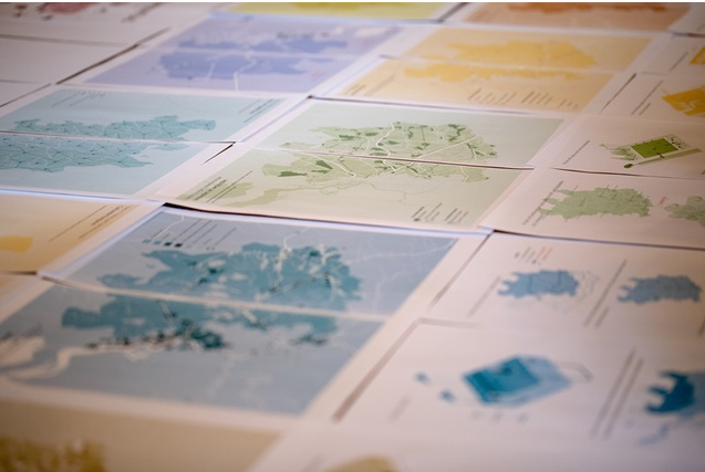
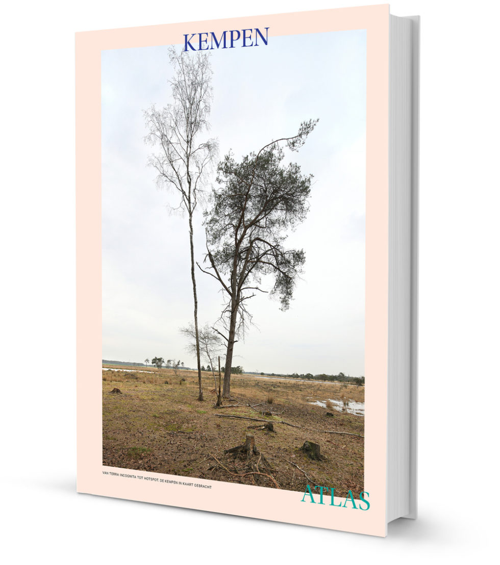
 MUST hat in Kooperation mit Rene Tichelaar einen Atlas für die belgische Region „De Kempen“ erarbeitet. Der Atlas soll die regionalen Entscheidungsträger, Planer und BewohnerInnen dazu einladen, anhand von Karten über die räumlichen Herausforderungen in der Region Kempen zu diskutieren. Zwölf thematische Karten geben einen Einblick in die räumliche Entwicklung und in die Zukunftsperspektiven der Region. Daneben zeigen zahlreiche Archivbilder die regionstypischen Orte der Kempen mit all ihren Facetten. Der Atlas kann über das Architekturzentrum AR-TUR erworben werden.
- Robert Broesi
- Oktober 2017
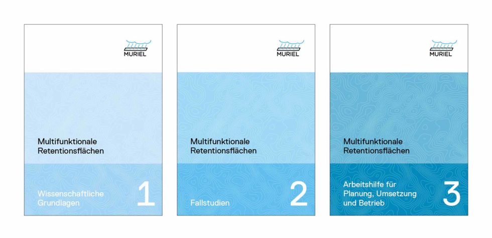
Im Juni 2017 wurde das durch die Deutsche Bundesstiftung Umwelt geförderte Projekt MURIEL – „Multifunktionale Retentionsflächen – von der Idee zur Realisierung“ abgeschlossen. Die drei Berichte können hier bei der DBU heruntergeladen werden (Suchbegriff „MURIEL“).
The beautifull Kempenatlas (with maps from MUST!) is finished! Now, it still needs to be printed. We need your help for this. Architecture centre AR-TUR has started a crowdfunding campaign to cover the printing costs for the atlas. You can donate from € 5,- on. In return you receive free entry tickets for the exhibition, free copies of the atlas and (digital) photos from Filip Dujardin. More information about donations can be found on this website. More information about the crowdfunding campaign and the Kempenatlas can be found in the video below (Dutch).
KEMPENATLAS: made possible by you! from AR-TUR on Vimeo.
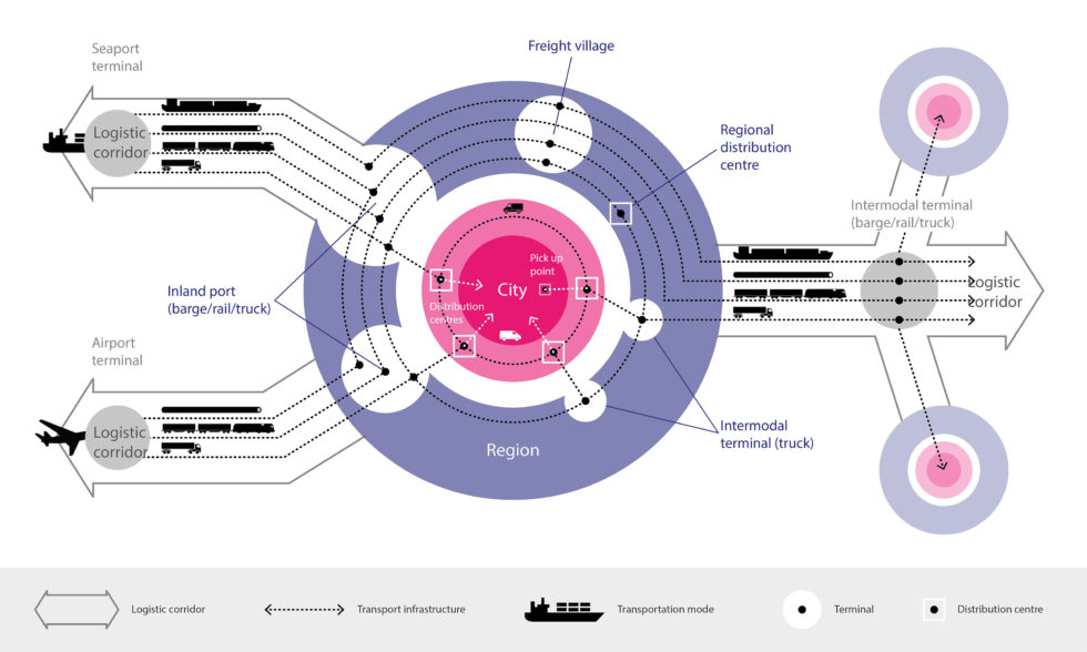 Road transport accounts for about 75% of goods transport on land today. Freight transport activity is projected to increase, with respect to 2005, by around 40% in 2030 and by little over 80% by 2050. The foreseen growth of freight transport in Europe asks for the optimisation of multimodal transport chains. The traditional focus by National Road Authorities (NRAs) on small-scope infrastructure planning faces difficulties meeting societal challenges and doesn’t consider the drivers of the freight and logistic sector. To guarantee network performance and efficient investment strategies National Road Authorities will have to be empowered with tools to influence the modal choice by the freight and logistic sector. CEDR (the Conference of European Directors of Roads) has commissioned MUST, together with TEMAH and ARUP to develop such a toolbox.
The hypothesis of the FLUXNET research is that an intelligent combination of tools from the field of spatial planning and infrastructure planning, taking into consideration the driving forces within the logistic and transport sector, can help influence the multi modal use. The FLUXNET research focuses on practice: an analysis of good practices will be used to construct a preliminary toolbox that will be tested in several workshops around Europe with regional infrastructure, logistics and planning experts.